- Home
- Things to see & do
- Outdoor & adventure
- Howth - Tramline Loop
Howth - Tramline Loop
- Loop
- Moderate
- 7.00km
- 2 hours
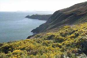
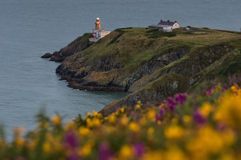
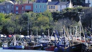
Wildlife enthusiasts will adore this area, particularly Ireland’s Eye and its bird sanctuary which boasts guillemots, razorbills, fulmars, gulls and gannets. If you’re lucky, you may even see grey seals diving for fish just offshore. This loop is one of four which starts at the DART (train) Station in the heart of the village. You are taken along the harbour before climbing away from the village around the Nose of Howth and onto the clifftops. Take in the stunning views of Lambay Island and Ireland’s Eye, and be overwhelmed by the heady scent of coconut from the bright yellow gorse on the heath. The Baily Lighthouse - the last of Ireland’s lighthouses to become automated - comes into view before you ascend to the highest point at ‘The Summit’ car park. From here you return to Howth Village via the route of the old tramline which has been developed as a walking trail.
A-B. Starting from the DART Station follow the blue arrow onto the promenade along the harbour. You are also following green, red and purple arrows which are for other loops. At the end of the prom, veer right onto Balscadden Road and ascend to reach Kilrock car park from where you join the well trodden cliff path.
B-C. Follow the cliff path for approximately 3km before turning right (leaving the longer purple loop) and ascending to reach The Summit car park.
C-D. Exit the car park through the height restriction barrier and join Bailey Green Road. Follow this road downhill to reach a junction of roads at The Summit Stores and pub.
D-E. Directly across from the bottom of Bailey Green Road, the entrance to the old tramline is marked by stone bollards. Cross Thormanby Road and join the tramline pathway. Follow the pathway downhill to exit directly opposite the DART Station - picking up the green, red and purple loops along the way.
Trail details
- Type:
- Walking Trail
- Location:
- Howth
- Ascent:
- 130
- Nearest town start:
- Howth Village
- Nearest town finish:
- Howth Village
- Start point:
- Howth Railway Station
- Finish point:
- Howth Railway Station
- Waymarking:
- Blue arrow on white background
- Carrickgollogan - Lead Mines Way - (Orange)Things to see & doHiking
- Barnaslingan - Scalp Lookout Trail (Red)Things to see & doHiking
- Wicklow WayThings to see & doHiking
- Royal Canal WayThings to see & doHiking
- Howth - Black Linn LoopThings to see & doHiking
- Grand Canal WayThings to see & doHiking
- The Dubline TrailThings to see & doHiking
- Howth - Cliff Path LoopThings to see & doHiking
- Ticknock - Fairy Castle LoopThings to see & doHiking
- HilltoptreksThings to see & doHiking
- Irish Cycling SafarisThings to see & doHiking
- Lambay Nature Walking ToursThings to see & doHiking
